Narmada Parikrama Route Directions – Complete Step-by-Step Travel Guide

Narmada Parikrama route map with distance in km from Amarkantak to Bharuch

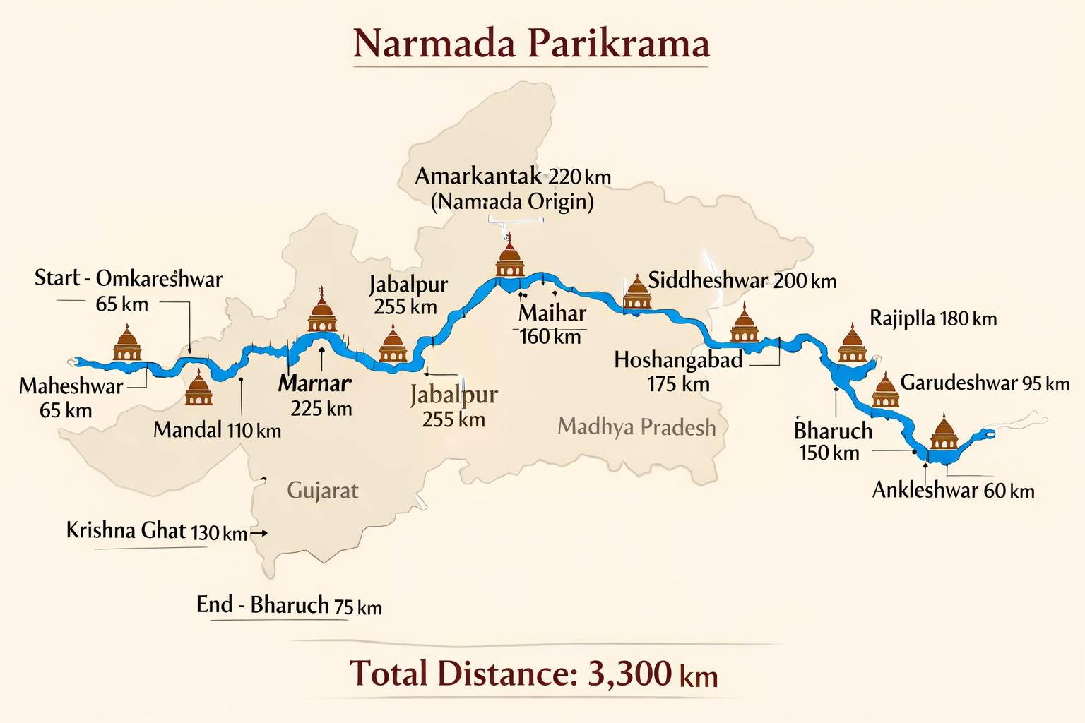
Narmada Parikrama Route – Combined Guide Narmada Parikrama Route Directions Table of Contents Introduction Sitaban–Nemawar( 93 K.M) From— To (Distance) Villages/Cities Enroute Places Of Spiritual Interest( Southern Side) The Way Of Narmada Parikrama Through Highway Is As Under:– The Second Way Of Narmada Parikrama Diverts From Lohara And Goes To Shulapaniswar Via Gora Colony. Another

New Pilgrims Facilities Announced

The sacred journey of Narmada Parikrama and pilgrimages along the holy river are set to become more comfortable and organized, as several new facilities have recently been announced by state governments and local administrations. These initiatives aim to honor the sanctity of the river while ensuring that pilgrims receive adequate support during their spiritual journeys.

Region-Specific Safety Tips for Narmada Parikrama

Along with general guidelines, parikramavasis should be aware of challenges that differ from region to region along Maa Narmada’s banks. 1. Amarkantak & Source Region 2. Jabalpur & Marble Rocks (Bhedaghat) 3. Omkareshwar & Mandhata Region 4. Maheshwar Ghats 5. Narmada South Bank (towards Gujarat) 6. Bharuch & Narmada Estuary (Gulf of Khambhat) 7. General